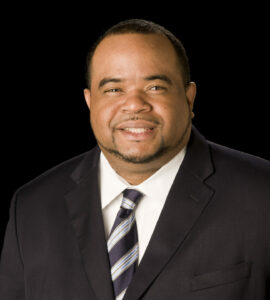
 Jenn Boelter
Building Envelope Professionals Group LLC |Oregon, WI
Jenn Boelter is the director of virtual modeling and chief pilot for Building Envelope Professionals Group LLC (BEPG). Boelter provides oversight and management of the BEPG drone program. Boelter routinely conducts 3-D photogrammetry data acquisition and modeling and continues to lead BEPG’s “drone to BIM” workflow development. She also provides laser scanning, point cloud development, and the integration of laser scanning and photogrammetry 3-D meshes.
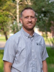
 Thomas Gernetzke, F–IIBEC, RBEC
Building Envelope Professionals Group LLC |Oregon, WI
Thomas Gernetzke, F–IIBEC, RBEC, is the principal consultant for Building Envelope Professionals Group LLC. Gernetzke is a past-president of IIBEC, was influential in the creation of the IIBEC Emerging Professionals Committee, and helped initiate the RCI–IIBEC Foundation Convention Scholarship program. He is currently serving as the chairman of the IIBEC Advocacy Committee and is a member of the IIBEC Jury of Fellows.
Session 2 of 3: Introduction to LiDAR and Its Uses in Building Enclosure and Beyond
9:30 a.m.–11:00 a.m.
Classification
BET
Article
This course has been approved for 1.5 IIBEC Continuing Education Hours.
Session Description
Light Detection and Ranging (LiDAR) is a remote sensing method that allows for the creation of accurate and detailed three-dimensional models of objects or spaces. LiDAR has the ability to resolve variations in the millimeter scale, collect millions of data points in a single scan, and be quickly collected from a number of platforms. This technology has been utilized in a variety of industries and continues to grow in use with new applications.
In this seminar, an introduction to LiDAR technology and its uses in the facility engineering realm is presented. A brief discussion on the concept of LiDAR, its field methods, and current uses within the industry will be followed by several project examples where LiDAR was used successfully. These examples have applications in the building enclosure discipline. In addition, other example projects where LiDAR has been used, including where it has been integrated with geophysical data, will be discussed to provide a complete overview of its current use and to facilitate discussion of other potential applications.
Learning Objectives
- Introduce the concept of LiDAR and its applications within the facility engineering field.
- Discuss and provide examples of LiDAR and the different types of data collection.
- Outline the different uses of LiDAR within the BEC science field.
- Identify when it is appropriate to use LiDAR within the industry.
Speaker
Session 3 of 3: Eye in the Sky: Mitigating Facade Access Risks Through Unmanned Aircraft System Aerial Imagery
11:15 a.m.–12:45 p.m.
Classification
BET, EW
Article
This course has been approved for 1.5 IIBEC Continuing Education Hours.
Session Description
Facade access has always been a high-risk endeavor for engineers, architects, consultants, and contractors. While regulation has reduced risks associated with facade access through the requirements associated with intermediate support anchors and tracks, many existing buildings have not had their facade access and fall arrest systems updated since their original construction under pre-existing code.
Walter P Moore & Associates has utilized drone imagery and data collection to capture facade information on a variety of projects to mitigate risks to their engineers. These efforts have reduced the amount of time spent on suspended and mobile scaffolds while still using traditional access methods to review areas of the building at arm’s length. Systematic drone aerial imagery capture also allows for reduced time on site, as imagery of the building can be captured in a measure of hours rather than days. Working in tandem with arm’s-length reviews, this methodology provides engineers with the ability to perform limited up-close assessments of the most critical areas of the building while reducing the amount of time required to be suspended on scaffolding.
Learning Objectives
- Identify hazards that are present on an existing building facade.
- Assess access methods used to review the conditions safely and informatively on a facade.
- Describe data capture mechanisms and methods for proper documentation of drone imagery.
- Discuss updated workflows for received data and the development of automated systems.
Speakers
 Michael Cobb
Walter P Moore & Associates | Houston, TX
Michael Cobb is an engineer in Walter P Moore’s Diagnostics Group. His experience focuses on the field of building enclosure consulting and restoration engineering. Cobb’s expertise includes evaluating and designing repairs for distress related to precast facades, concrete structures, and roofing systems. He is a certified Part 107 drone pilot. He has also developed work scopes, repair details, repair procedures, and technical specifications for waterproofing and structural restoration and rehabilitation projects.
 Kimani Augustine, PE
Walter P Moore & Associates | Houston, TX
Kimani Augustine is a senior project manager and principal in Walter P Moore’s Diagnostics Group. He has been in the industry since 2004 and has experience in diversified aspects of enclosure diagnostics, including conducting field visits and assessments of existing structures requiring retrofit or renovation. Augustine has led efforts on many building enclosure and parking restoration projects. He has taken the lead on several significant roof renovations, including project scopes that involve the assessment and repair of multiple roofing systems.


 Jenn Boelter
 Thomas Gernetzke, F–IIBEC, RBEC
 Robert Hendricks, PhD
 Michael Cobb
 Kimani Augustine, PE
 Cody Atkinson began his career in the fall protection industry nine years ago with Rooftop Anchor Inc. He is currently the vice president of the Mountain Division for Diversified Fall Protection and is devoted to helping clients make their rooftops safe. He has worked with numerous general contractors, roofing contractors, architects, roof consultants, safety managers, facility managers, and property managers over the course of his career.
 Dustin Schneider
 Eric Thill
 Kynan Wynne